Mesoscale eddies will have an impact on the circulation through various eddy-mean flow interactions such as in intergyre exchange and subtropical thermohaline processes. Eddies can also have dramatic effects on the nutrient and plankton distributions in the upper ocean - and are therefore essential for estimates of primary production. These mesoscale processes may also be important in the deep circulation and the fate of tracers at depths.
| Converging merdians in a spherical coordinate system lead to
issues of numerical stability and timesteps. In a novel technique to increase
the minimum timestep needed over the domain of the North Atlantic,
we integrate the model in a rotated grid system - one where the poles
lie within the plane of the equator.
Figures shown here are oriented back onto a grid of latitude and longitude. The domain extends from 20S to 74N and from 100W to 20E, with resolution of 1/6 degree (maximum north-south grid length is 18.5km and minimum is 9km). Vertical resolution increases from 25m in the surface waters to 500m in the deep ocean. The domain size is 576x672x21. The model is initialized with Levitus climatology and forced by surface winds. At the Southern boundary, climatological datasets are used to set water properties. |
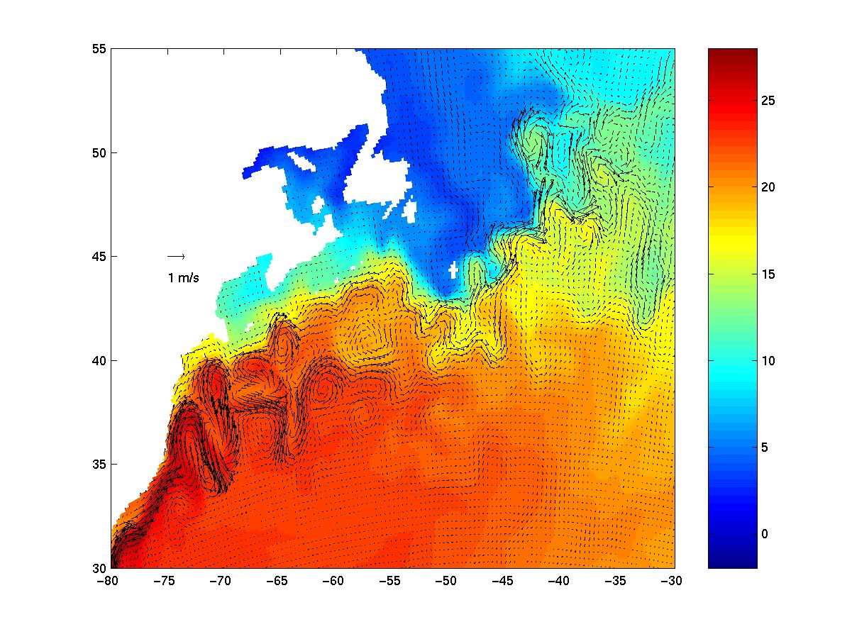
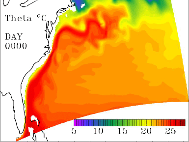
Temperature at 37.5m 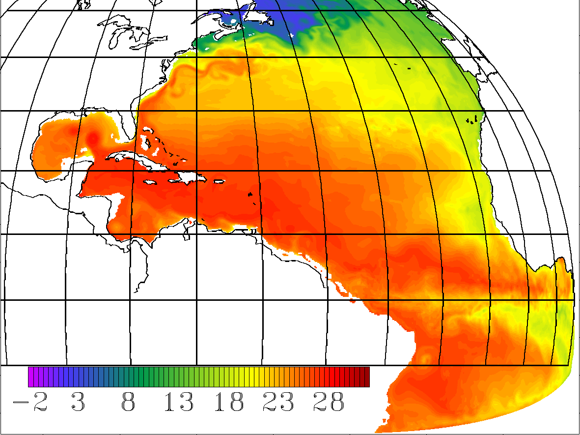
This model captures the effects of the Gulf Stream, deep water formation in high latitudes and vigorous Equatorial upwelling. |
| Click for animation
(Kbytes) of the early development of the model
|
The development and propagation of anomalously warm and cold eddies can be clearly been seen in the Gulf Stream region. The transport of warm water northward by the mean flow of the Gulf Stream is also clearly visible. Both processes, transport significant heat and so affect regional climate. They also impact nutrient distribution in the ocean, which affects all forms of marine life. |
Bathymeric details can have profound influence on the ocean mean
circulation. As an additional improvement to the model we more faithfully
represent the topography with the use of ``lopped'' cells. Here the bottom
cell of each column of water is determined to have a depth of the average
found in the cell, rather than having the depth dictated by the vertical
resolution. Below we show two representations of the bathymetry (taken
from ETOPO5 data): the first has full cells, the second has lopped cells.
The difference between the two is also shown.
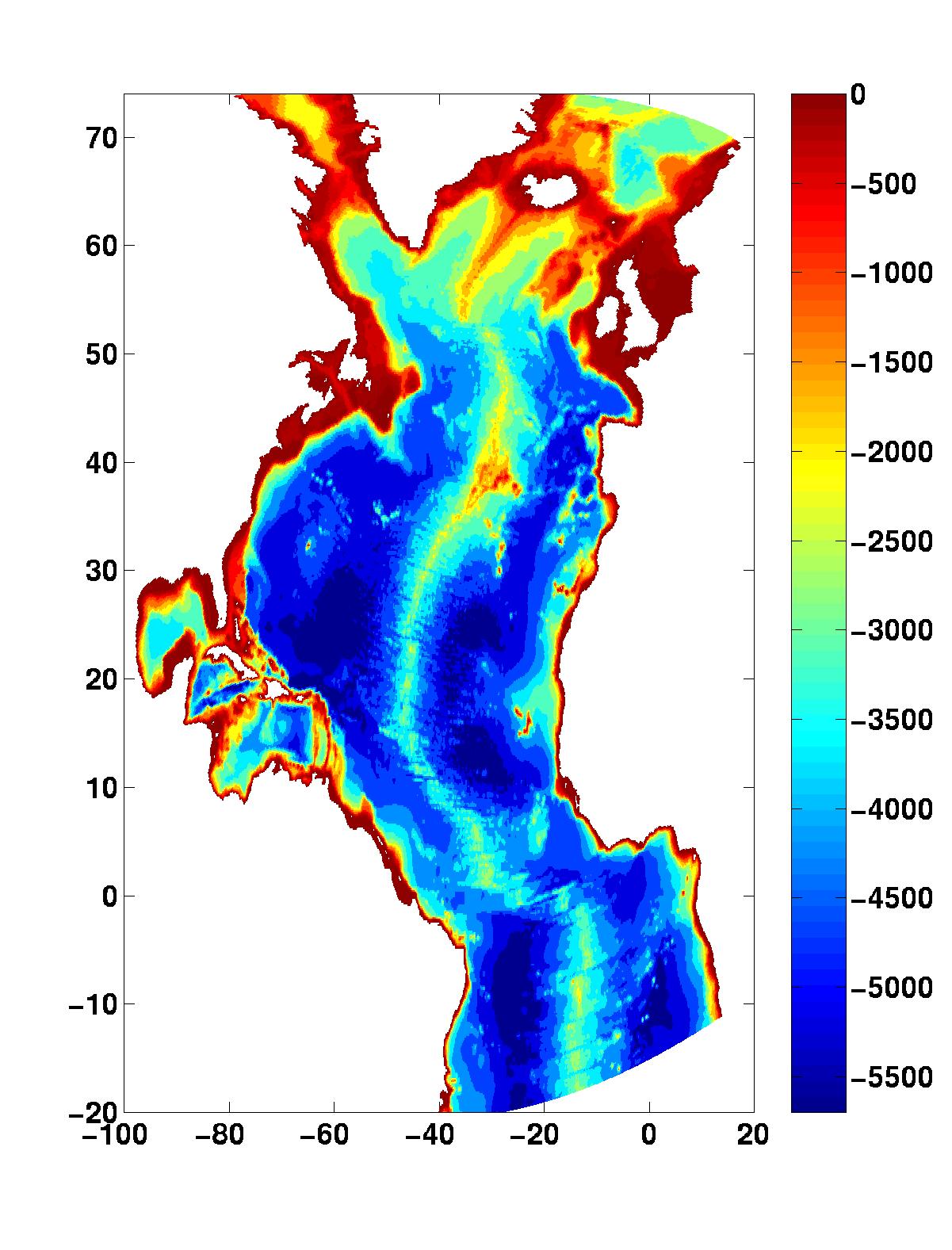
Full Cell Bathymetry |
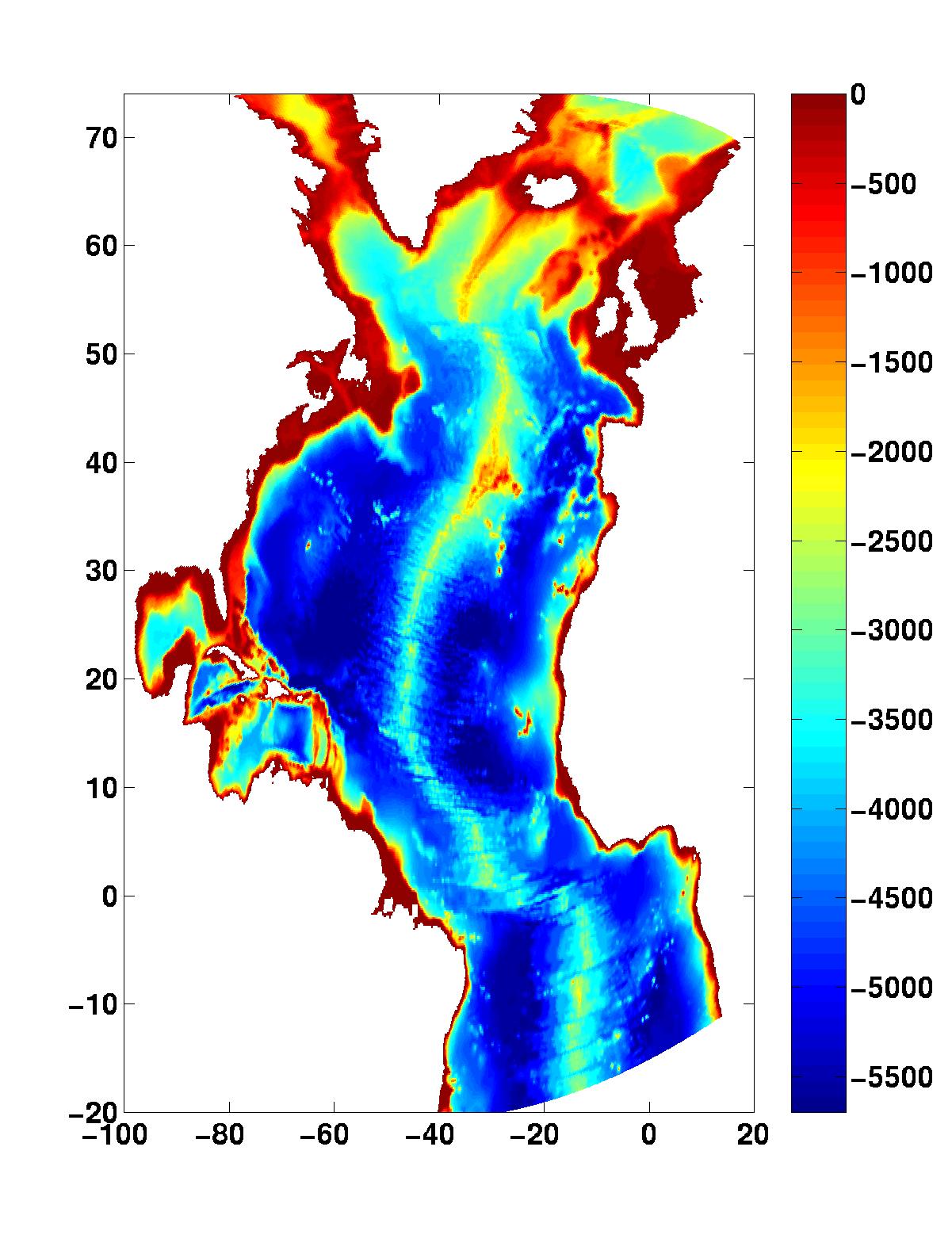
Lopped Cell Bathymetry |
Difference |
These simulations are being run on the Origin 2000, SGI Power Challenge
Array, part of the Scientific Computing Facilities and housed at Boston
University, on the NERSC DOE computing facilities
and on local cluster
computers at MIT.
