Latitude-Longitude Grid
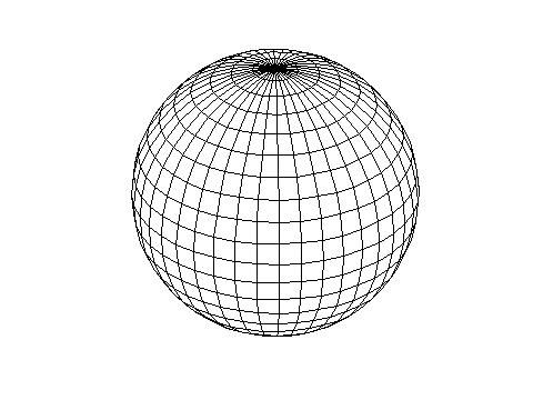 Most grid point atmospheric models (and almost all ocean models) are
discretized on a latitude-longitude grid (shown above). The meridians
(great arcs that join the poles) converge so that the zonal separation
becomes very small near the poles (shown in close-up below).
Most grid point atmospheric models (and almost all ocean models) are
discretized on a latitude-longitude grid (shown above). The meridians
(great arcs that join the poles) converge so that the zonal separation
becomes very small near the poles (shown in close-up below).
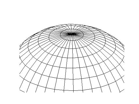 For the grid shown above, the zonal grid spacing scales with the
number of points around the equator to the power of two; doubling the
equatorial resolution quarters the zonal spacing in the last latitude
circle around the poles.
For the grid shown above, the zonal grid spacing scales with the
number of points around the equator to the power of two; doubling the
equatorial resolution quarters the zonal spacing in the last latitude
circle around the poles.